
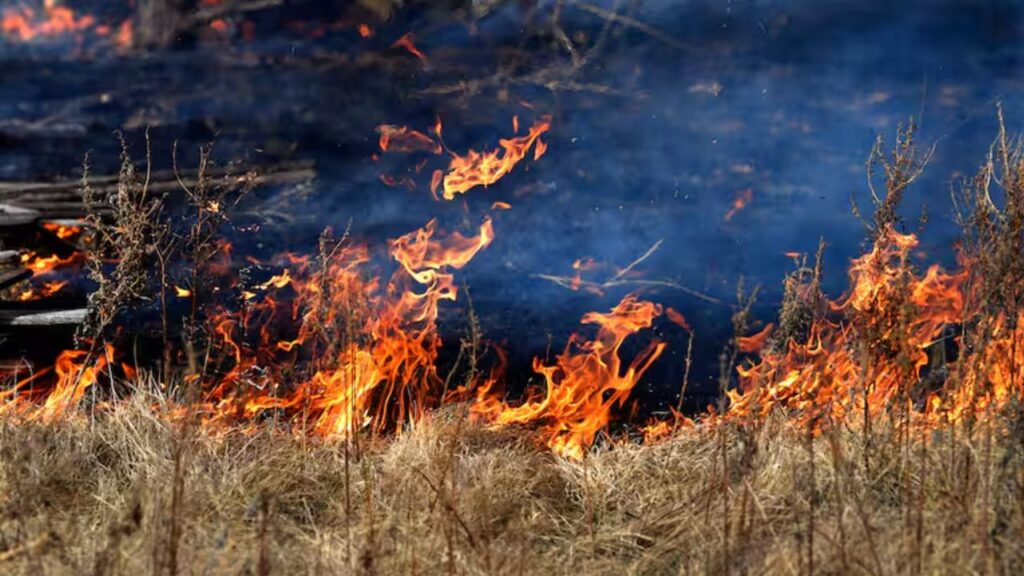
DENVER, Colo. — A combination of dry vegetation, persistent heat and drought conditions is raising concern about wildfire ignition as thunderstorms sweep across parts of the Plains this week.
While the storms are expected to bring much-needed rain to some areas, not every location will receive enough precipitation to offset the wildfire danger. In places where rainfall remains limited, lightning from thunderstorms could provide an additional spark to an already dry landscape.
The threat is especially important across portions of the High Plains, where severe thunderstorms are expected to develop Wednesday afternoon and evening.
Forecasters expect the most significant activity to focus on eastern Colorado and New Mexico, with the threat extending toward northwestern Texas, the Oklahoma Panhandle, western Kansas and southwestern Nebraska.
The Denver, Colorado Springs and Pueblo metro areas could also experience severe storms.
Lightning Could Ignite Brush Fires
The primary hazards from Wednesday’s storms are expected to include damaging hail and powerful wind gusts. However, lightning could become another concern.
Where storms produce lightning but little rainfall, dry vegetation and brush could ignite. That combination can create a particularly dangerous situation because a thunderstorm does not always eliminate the fire threat simply because rain is falling nearby.
Areas across the Plains that remain dry could therefore face a heightened risk of new brush fires sparked by lightning.
The storms may also bring rapidly changing conditions, with strong winds potentially helping any fire that starts spread more quickly.
Severe Storms Stretch From Chicago to the Ohio Valley
The severe weather threat will not be limited to the Plains.
Across the Midwest, thunderstorms are expected Wednesday afternoon and evening from the Chicago area toward Indianapolis and Fort Wayne, Indiana, as well as Champaign, Illinois, southern Michigan and northwestern Ohio.
These storms could produce damaging wind gusts and localized flash flooding, creating additional hazards for drivers and communities.
Storm activity is also expected across portions of the lower Mississippi Valley.
Arkansas and northern Louisiana through central and northern Mississippi and southwestern Tennessee could experience storms capable of producing damaging winds and flash flooding.
That combination could make travel difficult, particularly in areas where storms repeatedly move over the same locations.
Heavy Rain Threat Shifts East Thursday and Friday
By Thursday and Friday, the focus of severe weather and heavy rainfall is expected to shift toward the eastern third of the United States.
Most thunderstorms will not become severe, and most rainfall is not expected to cause flooding. Still, the strongest storms could bring damaging winds, localized flash flooding and significant travel disruptions.
Heavy downpours could develop from eastern New York southward toward the central Carolinas and Georgia. Urban areas could be particularly vulnerable to brief flooding when rainfall comes down faster than drainage systems can handle it.
The threat could also extend farther west along the Interstate 81 corridor from Virginia to New York, including the Washington, D.C., metropolitan area.
I-95 Corridor Could See Travel Disruptions
Friday could bring another round of heavy, gusty and locally severe thunderstorms along the central and southern Atlantic Seaboard.
Cooler Air Brings Relief to Pennsylvania, But Midweek Warmth and Thursday Storms Are Ahead
Storms and downpours could affect Washington, D.C., Richmond, Virginia, Charlotte, North Carolina, and Columbia, South Carolina.
For people traveling along the Interstate 95 corridor, the combination of heavy rain, strong wind gusts and reduced visibility could create difficult driving conditions.
Thunderstorms could also lead to temporary delays for outdoor events and other activities across the region.
New York City Records an Exceptionally Wet August
The shift toward wetter conditions in the Northeast comes as New York City is already experiencing an unusually wet month.
The city has recorded 8.04 inches of rain in August, making this the wettest August there since 2021, when 10.32 inches was recorded.
Unlike that August, when Tropical Storm Henri contributed significantly to the rainfall total, no tropical storms have boosted New York City’s rainfall this month.
The contrast highlights how dramatically weather conditions can vary across the country. While parts of the Northeast have experienced repeated heavy rain, areas farther west and in the Plains continue to face concerns over heat, dryness and wildfire ignition.
As thunderstorms move east through the week, residents and travelers should remain alert for rapidly changing weather conditions, lightning, strong winds, flooding and fire danger.
Are severe storms or wildfire concerns affecting your area this week? Share what you’re seeing in the comments.









One thought on “Heat, Drought and Lightning Put Texas, Nevada, California and Washington on Alert as Wildfire Threat Intensifies Across the West”