Dallas, Texas — North Texas residents will have to endure a few more days of heat and humidity before a late-week cold front brings a noticeable change to the weather across the Dallas-Fort Worth area.
Daytime temperatures are expected to remain around 10 to 15 degrees above normal over the next couple of days. However, a cold front forecast to arrive late Thursday night could bring significantly cooler temperatures and lower humidity, making conditions feel more like fall by next weekend.
Rain and storm chances will also return to the forecast Wednesday and Thursday, although not everyone across the region is expected to see precipitation.
DFW Weather Forecast: Heat and Humidity Continue
The unusually warm conditions are expected to persist across Dallas-Fort Worth through the middle of the week.
High temperatures will remain well above seasonal averages, while elevated humidity could make outdoor conditions feel uncomfortable during the afternoon. Residents planning outdoor activities should be prepared for continued summer-like weather despite the calendar moving further into fall.
The biggest change is expected later in the week, when the approaching cold front moves through North Texas.
According to the forecast, temperatures should come down significantly by next weekend. Humidity levels are also expected to drop, potentially delivering a welcome break from the warm and muggy conditions.
For residents waiting for more comfortable fall weather, the late-week system could mark an important transition toward cooler conditions.
Rain Chances Return Wednesday and Thursday
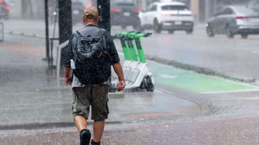
Rain chances are expected to increase Wednesday and Thursday as the weather system approaches North Texas.
Current projections suggest that the better opportunity for showers and storms could develop late Wednesday night and into Thursday morning. However, the timing and coverage remain uncertain and could change as the system gets closer.
Storm chances are expected to remain relatively limited across the region, meaning rainfall may be scattered rather than widespread.
Some communities could receive showers or thunderstorms, while other locations may stay completely dry. Residents should avoid assuming that rain will reach every part of the Dallas-Fort Worth area.
The amount of rainfall will depend on how the system develops and where individual storms form. Updated forecasts should provide more clarity about which communities have the best chances of seeing precipitation.
Cold Front Expected Late Thursday Night
The main weather change is expected when the cold front moves through North Texas very late Thursday evening.
Unlike the limited storm coverage, the temperature change associated with the front is expected to affect the broader Dallas-Fort Worth region.
The front should bring cooler air into the area, helping daytime temperatures move closer to more comfortable fall conditions. Lower humidity will also make a difference, reducing the muggy feeling that has accompanied the recent stretch of above-normal warmth.
The precise temperature drop will depend on the final forecast, and specific high and low temperatures have not been provided in the available outlook.
Still, the overall pattern points toward a noticeable change between the first part of the week and the weekend.
Will Everyone See Rain Before the Cooldown?
Not necessarily. Although storms are possible Wednesday and Thursday, forecasters expect coverage to remain limited.
That means rainfall could vary significantly across the Metroplex and surrounding North Texas communities. Areas that receive storms may experience a brief period of heavy rain, gusty winds or lightning, while nearby locations could see little or no precipitation.
Residents should keep an eye on updated weather information, particularly if they have outdoor plans Wednesday night or Thursday morning.
El Niño Winter Forecast Sparks New Snow Concerns for New York, Chicago and Other US Cities
Even if a particular location misses the rain, the approaching cold front is still expected to bring cooler air into the region.
What DFW Residents Should Expect This Weekend
The week is shaping up to feature two distinct weather patterns: continued heat and humidity through the middle of the week, followed by a cooler and less humid period after the front arrives.
The most important forecast details to watch are the timing of Wednesday and Thursday’s storm chances, the eventual coverage of rainfall and how quickly temperatures fall behind the front.
For now, residents should prepare for warm afternoons over the next couple of days while keeping an eye on possible storms before the weather turns cooler.
After several days of above-normal temperatures, the late-week cold front could finally deliver the fall-like conditions North Texas residents have been waiting for.
Are you ready for cooler weather in Dallas-Fort Worth, or do you prefer the warmer temperatures? Share your thoughts and local weather conditions in the comments below!