
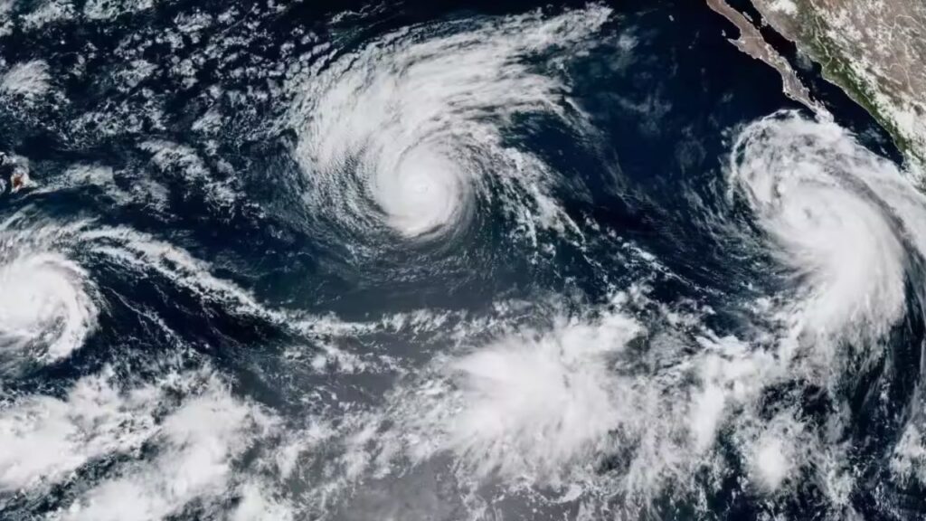
HAWAII — Residents and visitors across the Hawaiian Islands are watching Hurricane Lowell closely after the powerful storm made a northward turn Sunday and its projected path shifted slightly east.
The change prompted officials to issue a tropical storm warning and hurricane watch for Kauai and Niihau, raising concerns that the islands could experience stronger winds and more significant impacts than previously expected.
Although Lowell is not currently forecast to make a direct landfall in Hawaii, the storm is expected to pass close enough to bring heavy rain, dangerous surf and potentially severe weather across the island chain.
The National Hurricane Center warned that any additional eastward shift could increase the threat, particularly for Kauai and Niihau.
Lowell Remains a Dangerous Category 3 Hurricane
At 5 p.m. HST Sunday, Sept. 6, Lowell was located about 500 miles south-southwest of Lihue on Kauai and roughly 525 miles southwest of Honolulu.
The storm had maximum sustained winds of 120 mph, making it a Category 3 hurricane.
Forecasters said Lowell was accelerating after turning north and was expected to move north to northeast across portions of the Papahānaumokuākea Marine National Monument.
Gradual weakening is expected to begin as the storm approaches Hawaii. However, officials still expect Lowell to remain a hurricane as it nears the western end of the main Hawaiian Islands.
The latest forecast places the center approximately 115 to 150 miles west of Kauai.
That distance is close enough that even a modest shift east could produce stronger winds and more serious impacts.
Kauai and Niihau Face Strongest Wind Threat
The eastward adjustment in Lowell’s forecast track has increased concern for hurricane-force wind gusts on Niihau and potentially Kauai, especially in higher elevations.
Tropical storm-force winds extend as far as 175 miles from the center, while hurricane-force winds reach outward roughly 50 miles.
Forecasters are also warning about possible tornadoes.
Hurricane Lowell Could Near Hawaii Next Week—Here’s What the Latest Track Shows
Several tornadoes could develop near Kauai and Niihau on Labor Day and overnight, while isolated tornadoes are possible elsewhere across the Hawaiian Islands.
Residents should therefore continue monitoring official weather updates even if the storm’s center remains offshore.
Flood Watch Covers Much of Hawaii
Rain is expected to become one of the biggest threats as moisture associated with Lowell moves across the state.
The National Weather Service has issued a flood watch through 6 p.m. HT Tuesday, Sept. 8, for Maui, Lanai, Molokai, Oahu, the Big Island and Kahoolawe.
Forecasters expect the heaviest rainfall initially in windward and mountain areas, before the threat expands across more locations.
Flood-prone roads and low-lying areas could experience dangerous runoff, while overflowing streams and rapid rainfall could cause flash flooding.
Urban areas may also face flooding and property damage when water accumulates faster than drainage systems can handle it. Mountainous areas could see mudslides and additional runoff dangers as rainfall continues.
Rainfall Could Reach More Than 14 Inches
The rainfall forecast is particularly concerning for some islands.
Kauai and the Big Island could receive approximately 4 to 10 inches of rain, with isolated areas potentially recording more than 14 inches.
Maui could receive around 2 to 4 inches, with locally higher totals approaching 8 inches. Other parts of the state are expected to receive approximately 1 to 2 inches.
Heavy rain could continue through Tuesday, increasing the possibility of flash flooding as the storm’s moisture spreads across the island chain.
Dangerous Surf and Rip Currents Expected
Hurricane Lowell is also expected to create dangerous coastal conditions. Large waves and life-threatening rip currents are forecast along many Hawaiian shorelines during the coming days.
The Maui County Fire Department urged residents and visitors to use extra caution around beaches and shorelines, warning that larger-than-normal waves and stronger-than-usual currents could develop.
Officials specifically cautioned inexperienced ocean users against entering the water while conditions deteriorate.
Storm surge could also raise water levels approximately 1 to 3 feet above normally dry ground in Kauai County, while Oahu could see rises of up to 1 foot if peak water levels coincide with high tide.
Hawaii Residents Urged to Prepare Now
Emergency officials are urging residents to complete hurricane preparations before conditions worsen.
People should know their evacuation zones, avoid driving through flooded roads and continue monitoring official forecasts for changes to watches and warnings.
Emergency supplies should also be ready, including food, water, medications, flashlights, batteries and multiple ways to receive weather alerts.
While Hurricane Lowell is expected to remain offshore, officials stress that its close approach could still produce dangerous conditions across Hawaii.
With the storm continuing to move north and the forecast track having already shifted east, residents should remain alert through Labor Day and into Tuesday.
Are you in Hawaii or planning to visit the islands this week? How are you preparing for Hurricane Lowell? Share your thoughts in the comments.









One thought on “Powerful Hurricane Lowell Nears Hawaii With Heavy Rain, Dangerous Surf and Tornado Risk”