LOS ANGELES, Calif. — Southern California is beginning to dry out after a wet stretch brought on by the remnants of Hurricane Marie, but residents should not expect the weather to become completely comfortable just yet.
Marie remained well offshore, but the system still managed to send rain, increased humidity and rough surf toward Southern California.
After a day marked by widespread showers, rainfall is gradually moving away from the region. Most showers are expected to weaken overnight and into Monday morning, although some locations could still experience scattered, short-lived rainfall during the early morning hours.
As the rain disappears, another weather concern is moving to the forefront: rising humidity and increasing temperatures.
Muggy Conditions Take Over Monday
Once the showers move out, Southern California will remain noticeably humid.
High Surf and dangerous Rip Currents are expected Labor Day weekend into early next week. Coastal Flooding is possible especially for vulnerable south-facing coasts. Always swim near a lifeguard, Stay off rocks and Jetties. Heed advice from Local officials.#CAwx pic.twitter.com/e0vabebXMQ
— NWS Los Angeles (@NWSLosAngeles) September 3, 2026
Los Angeles and Orange counties are expected to see warm and humid conditions Monday, with temperatures reaching a high of 85 degrees and falling to around 69 degrees overnight.
The combination of lingering moisture and rising temperatures could make the day feel considerably more uncomfortable than the temperature alone suggests.
Conditions will become even warmer as the week progresses. Forecast temperatures are expected to climb into the upper 80s and low 90s by midweek, while some areas could continue to see lingering shower chances.
For residents hoping the recent rainfall will bring an extended break from summer heat, the forecast suggests that relief may be short-lived.
Inland Areas Face Triple-Digit Heat
The warmest conditions are expected farther inland. The valleys and Inland Empire could reach around 92 degrees Monday, with overnight temperatures dropping to approximately 72 degrees.
But the bigger concern arrives later in the week.
Triple-digit heat is expected to enter the forecast by Wednesday, potentially creating dangerous conditions for people spending extended periods outdoors.
The return of extreme heat will be especially important for people who work outside, exercise outdoors or have limited access to cooling.
Residents in inland communities should be prepared for temperatures to rise sharply after the temporary influence of Hurricane Marie fades.
Coastal Areas Face Dangerous Surf
While inland communities prepare for rising heat, Southern California’s coastline has a different concern.
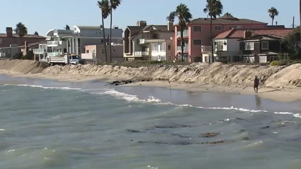
High surf advisories and coastal flood advisories are in effect for portions of Los Angeles and Ventura counties, where high tides and large waves could cause minor flooding in vulnerable coastal locations through early next week.
Beach communities should also be alert for dangerous rip currents. Waves could reach 6 to 10 feet, creating hazardous conditions even as skies begin to clear.
On Monday, beach communities are expected to reach a high near 78 degrees, with an overnight low around 71 degrees. Surf could remain elevated, with waves potentially reaching 10 feet.
Beachgoers should use extra caution and pay attention to local warnings before entering the water.
Mountains and Deserts See Different Weather
Southern California’s varied terrain will produce noticeably different conditions Monday.
Mountain communities have a 30% chance of thunderstorms, with temperatures reaching around 72 degrees and dropping to approximately 52 degrees overnight. Rain chances could continue in the mountains through Thursday.
Desert areas have a smaller 10% chance of showers Monday, but temperatures will remain much warmer.
Powerful Hurricane Lowell Nears Hawaii With Heavy Rain, Dangerous Surf and Tornado Risk
Palm Springs is expected to reach a scorching 101 degrees, highlighting the sharp contrast between the region’s coastal and inland climates.
Heat Builds as Rain Chances Linger
Southern California’s weather is therefore entering a complicated pattern. The influence of Hurricane Marie is fading, but the moisture it brought is not disappearing immediately.
Rainfall will gradually decrease while humidity and temperatures increase, creating muggy conditions Monday and hotter weather later in the week.
The most significant change will come inland, where triple-digit temperatures could return by Wednesday.
At the same time, coastal residents must continue watching for dangerous surf and rip currents, while mountain communities remain alert for additional thunderstorms.
For now, the rain is moving out—but Southern California’s summer heat is preparing to take its place.
How is the weather looking where you live in Southern California? Are you ready for the heat to return? Share your thoughts in the comments.