Chicago, Illinois — The flash flood threat is increasing across parts of the Midwest, with another round of heavy rain expected to move across areas that are already saturated after significant rainfall earlier in the week.
The greatest concern stretches from northern Illinois through northern Indiana and into western Ohio, putting major cities including Chicago, Indianapolis and Columbus at risk for localized flash flooding. Additional rain could begin causing problems quickly because the ground has limited capacity to absorb more water.
Chicago to Columbus Face More Flooding
Heavy rainfall is expected to continue affecting parts of the Midwest through Monday morning.
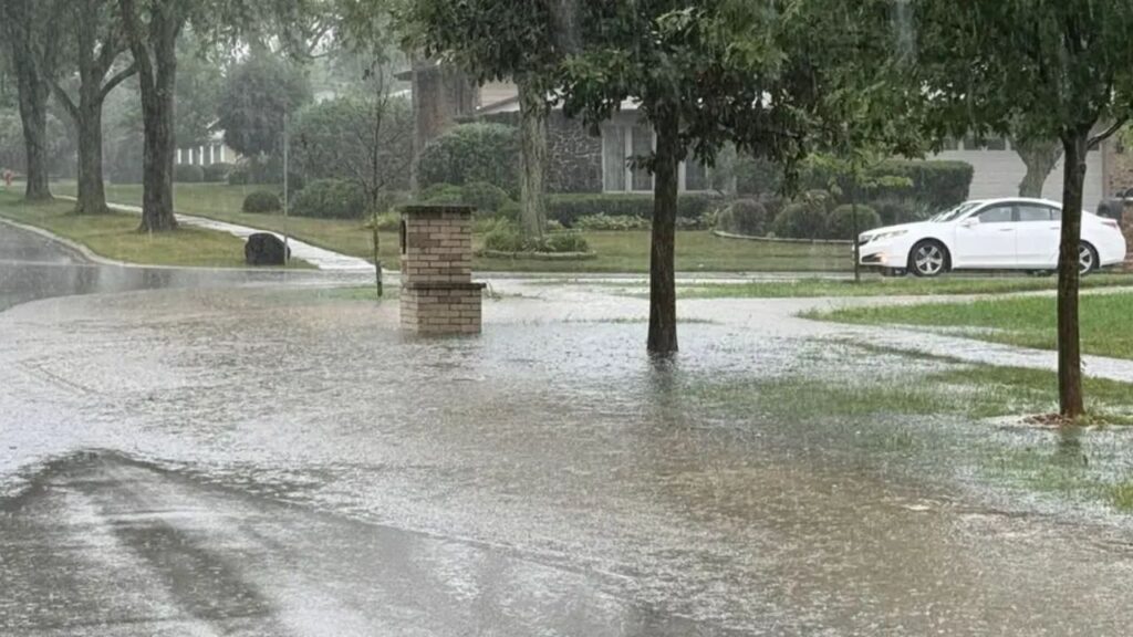
The threat is particularly concerning across areas that received substantial rainfall Saturday. With the ground already saturated, even additional rainfall that would normally be manageable could produce flooding in low-lying areas, streets and drainage systems.
The corridor from Chicago toward Columbus is expected to remain one of the main areas of concern.
Cities including Chicago, Indianapolis and Columbus could experience localized flash flooding if heavier thunderstorms repeatedly move over the same locations.
Residents in flood-prone neighborhoods should remain alert for rapidly rising water, especially during periods of intense rainfall.
Heavy Rain Could Continue Through Monday
The threat is not expected to end immediately.
Through Monday morning, heavy rain could linger from northern Illinois into northern Indiana and western Ohio, while the unsettled weather pattern also expands toward portions of the Northeast.
The combination of additional rainfall and already-saturated soil is creating an elevated flooding risk.
Some locations could receive another round of heavy downpours while nearby areas see considerably less rain. That makes the exact location of stronger thunderstorms particularly important when determining where the most serious flooding develops.
Eastern Iowa to Western Ohio Remains a Concern
One of the most closely watched areas extends from eastern Iowa across northern Illinois and northern Indiana into western Ohio.
This corridor has already experienced flooding rain, and another round of significant rainfall could cause problems to return.
The biggest concern is that repeated rainfall could overwhelm drainage systems and cause water to accumulate rapidly on roads and in low-lying locations.
Flash flooding is possible, and some river flooding could develop as additional water moves through already-saturated areas.
The threat could be especially significant where thunderstorms repeatedly track over the same communities instead of moving through quickly.
Why Is So Much Rain Falling in the Midwest?
The unusual rainfall pattern is tied to a larger weather setup across the central and eastern United States.
Rounds of rain and thunderstorms are traveling around the outer edge of a heat dome over the Southeast. At the same time, fronts attempting to move into the region are slowing dramatically.
Instead of quickly pushing through the Midwest, these boundaries can stall, allowing storms to repeatedly develop and move across similar areas.
That setup can create a dangerous cycle: rain falls, the ground becomes saturated, and additional storms arrive before the water has time to drain away.
The result can be significant flooding even without one exceptionally powerful storm.
More Rain Could Create Bigger Problems
The immediate concern is not simply how much rain falls, but where the heaviest rain repeatedly occurs.
Days of Dangerous Surf and Coastal Flooding Are Coming as a Major Nor’easter Takes Shape
Areas that received heavy rainfall earlier in the week have less room to absorb additional water. If another round of intense storms develops over the same corridor, flash flooding could develop quickly.
Chicago and surrounding communities in northern Illinois, along with parts of Indiana and Ohio, will therefore need to keep a close eye on changing conditions through Monday.
For drivers, flooded roads can become dangerous with little warning, particularly during nighttime storms when water depth is harder to see.
The threat will gradually depend on how quickly the rain moves out and whether additional storms continue forming along the stalled weather boundaries.
Are you in Chicago, Indianapolis, Columbus or another part of the Midwest? Have you already seen flooding from this week’s rain? Share your local conditions in the comments.