
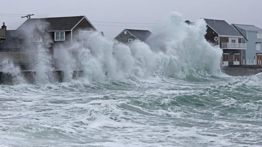
Boston, Massachusetts — A powerful nor’easter is taking shape along the East Coast, with several days of strong winds, dangerous surf, coastal flooding and severe beach erosion expected as the storm gradually strengthens and tracks north toward New England.
The system is expected to begin developing Monday as a sharp fall cold front moves offshore while strong high pressure builds to the north. That setup will help generate persistent northeasterly winds across coastal and offshore waters, creating increasingly dangerous conditions along the shoreline.
The storm could remain a threat for much of the week before eventually moving toward the Northeast and New England.
Dangerous Surf Will Build Along the Coast
As the system strengthens, seas are expected to rise rapidly, producing powerful waves and dangerous surf along exposed beaches.
Persistent onshore winds could continue through multiple high-tide cycles, repeatedly pushing waves against coastal dunes. That prolonged wave action could cause significant beach erosion and dune damage from the Outer Banks through the Mid-Atlantic and Long Island.
The combination of strong winds and high waves will be particularly concerning because coastal water may have little opportunity to drain between high tides.
That could allow flooding to worsen with each successive tidal cycle.
Outer Banks Face Major Coastal Impacts
The Outer Banks of North Carolina are expected to experience some of the most significant early impacts.
Forecast conditions include major coastal flooding, extreme surf and periods of heavy rain. Some locations could see wind gusts reaching 40 to 50 mph, while offshore waves could climb to 15 to 18 feet.
Although widespread flash flooding is not currently expected, persistent rainfall combined with powerful waves could create serious coastal problems.
Ocean overwash could reach vulnerable coastal roads, including Highway 12, potentially making travel difficult or dangerous.
Repeated wave action could also produce severe beach erosion and damage dunes that protect coastal communities from the ocean.
Flooding Could Spread Through the Mid-Atlantic
By Thursday and Friday, the surface low-pressure system is expected to strengthen off the Southeast and Mid-Atlantic coasts.
As the storm intensifies, onshore winds will become stronger, pushing additional water toward the coastline.
Water could become trapped in back bays and other coastal areas, preventing it from fully draining between high tides. That could result in consecutive periods of elevated tidal flooding.
The threat could eventually spread across North Carolina, Virginia, Maryland, Delaware and New Jersey, with impacts extending into southern New England.
Multiple days of pounding waves could also cause substantial damage to beaches, dunes, oceanfront boardwalks and other coastal infrastructure across the Mid-Atlantic and Long Island.
Boston Could Face the Strongest Storm Conditions
By Saturday and Sunday, the low-pressure center is expected to move north toward the I-95 corridor and New England, potentially solidifying into a classic nor’easter.
The exact track will be critical in determining which communities experience the strongest impacts.
If the low moves closer to Boston, the region could face a much more significant storm, with wind gusts potentially reaching 60 to 70 mph, heavy rain, major storm surge and disruptions around Boston Harbor and the Massachusetts coastline.
A track closer to New Jersey or Long Island could shift the most significant impacts farther south, while potentially leaving New York City closer to the northern edge of the strongest conditions.
If the low remains farther offshore, coastal New England could still experience rough surf, elevated tides and strong winds, while the heaviest rainfall and strongest winds remain farther south and east.
60+ MPH Winds and Huge Waves Are Possible
As the storm reaches southern New England, Massachusetts Bay and the Gulf of Maine, wind gusts could exceed 60 mph in some locations.
Dangerous Rain Is Coming for Nearly 24 States as Flooding Threat Grows Across the U.S. Into Next Week
Coastal waves could again reach 15 to 18 feet, creating dangerous conditions along exposed shorelines.
The greatest coastal flooding risk would come from the combination of strong onshore winds, high astronomical tides and water trapped along the coast.
East-facing shores, including Boston Harbor, Cape Cod and the north and south shores of Massachusetts, could be particularly vulnerable to significant coastal inundation and structural flooding.
Ocean Conditions Could Become Extremely Dangerous
Officials are also warning about the dangers in the water.
The strengthening storm could produce massive swells, dangerous seas and extreme rip currents, making ocean conditions hazardous even for experienced swimmers and boaters.
With the storm potentially affecting the East Coast for several consecutive days, conditions could deteriorate gradually rather than arriving as a single burst of severe weather.
For coastal residents, the biggest concerns will be flooding, erosion, overwash and prolonged wave action as the nor’easter develops and moves north.
Are you on the East Coast and preparing for the potential nor’easter? Share your city and state in the comments and let us know what conditions you’re expecting as the storm approaches.








One thought on “Days of Dangerous Surf and Coastal Flooding Are Coming as a Major Nor’easter Takes Shape”