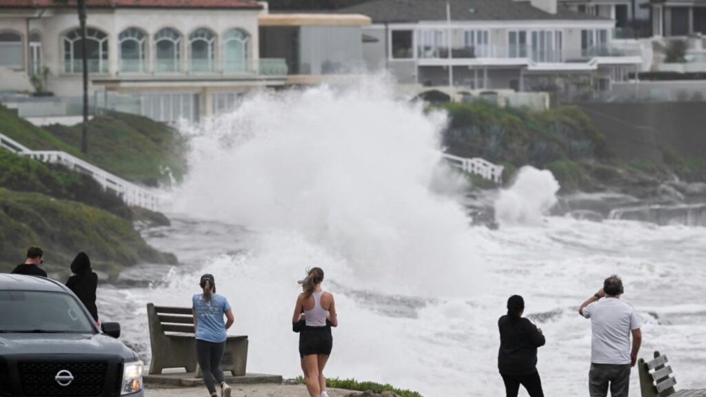
Miami, Florida — The Atlantic hurricane basin is expected to remain relatively quiet this week following Hurricane Isaias, with forecasters monitoring just one distant area of disturbed weather in the eastern Atlantic. Although the latest outlook offers some relief, the 2026 hurricane season is not over, and history shows that powerful storms can still develop late in the season.
The latest forecast indicates that an area of low pressure west of the Cabo Verde Islands is the only system showing a consistent signal for possible tropical development. However, strong upper-level winds are preventing thunderstorms from organizing, and forecast models currently suggest limited development potential.
One Area of Disturbed Weather Remains Under Watch
The area attracting attention is located far out in the eastern Atlantic, west of the Cabo Verde Islands off the coast of West Africa.
A broad area of storminess has developed around a low-pressure system, but the thunderstorms remain disorganized. Strong upper-level winds blowing from the west are disrupting the system and pushing thunderstorm activity away from the low-pressure center.
These conditions make it harder for a tropical cyclone to form and strengthen.
Forecast models are showing little enthusiasm for the system’s development, while the National Hurricane Center has assigned it minimal chances of becoming a tropical system over the next day or two, according to the provided outlook.
Increasingly hostile upper-level winds are also expected to work against the disturbance.
For now, the system does not appear to pose an immediate tropical threat to the United States. However, conditions can change, making updated forecasts important during the remaining weeks of hurricane season.
Hurricane Season Is Entering Its Final Weeks
October marks a transition toward the quieter portion of the Atlantic hurricane season, but tropical activity does not stop completely.
Historical figures cited in the outlook indicate that approximately 90% of U.S. hurricane landfalls have occurred by October 12, with about 85% of seasonal activity typically behind us by that point.
November hurricane strikes are considerably less common, but they remain possible.
Hurricane Nicole, which made landfall in Florida on November 10, 2022, is a recent reminder that tropical systems can remain dangerous late in the year. Historical records dating to 1851 show only four hurricanes making landfall in the United States during November, according to the supplied report.
The declining seasonal odds should therefore not be mistaken for a guarantee of safety.
Residents in hurricane-prone areas should continue monitoring official forecasts and keep their emergency plans ready until the season officially ends on November 30.
Isaias Changed the 2026 Hurricane Season’s Activity Record
Before Hurricane Isaias strengthened late last week, the 2026 Atlantic hurricane season had recorded the lowest accumulated cyclone energy (ACE) of any season in the reliable record dating to 1950, according to the outlook.
ACE measures the combined intensity and duration of tropical cyclones and helps meteorologists compare overall seasonal activity.
Isaias, which reached Category 3 intensity, added more than seven ACE units to the seasonal total. That represented an increase of approximately 70% in the season’s accumulated ACE, despite the relatively small contribution compared with a typical active hurricane season.
Through October 12, 2026, the season’s overall activity was running slightly ahead of the levels recorded in 1983 and 1994, the report said.
El Niño Winter Forecast Sparks New Snow Concerns for New York, Chicago and Other US Cities
Both of those historical seasons recorded three hurricanes, compared with one hurricane reported so far in 2026. Even if the current season ended immediately, 1983 would still rank as less active overall, according to the supplied comparison.
Quiet Seasons Can Still Produce Dangerous Hurricanes
The historical record offers an important reminder: a quiet hurricane season does not necessarily mean a season without significant damage.
In 1983, Hurricane Alicia struck the Texas coast as a Category 3 storm. In 2026, Hurricane Isaias demonstrated how quickly a relatively quiet season can change when a powerful system develops.
The comparison also highlights why seasonal activity totals alone cannot determine the danger facing a particular community. A single landfalling hurricane can have serious consequences even when the overall season produces fewer storms than average. The possibility of late-season development remains one reason forecasters continue monitoring the Atlantic.
What Happens Next?
For the coming week, the outlook points to limited tropical development potential, with the distant disturbance near the Cabo Verde Islands remaining the main area to watch.
Strong upper-level winds are currently limiting its chances of organizing, but the situation could change if atmospheric conditions become more favorable.
For coastal communities, the best approach is to stay informed rather than assume the season has ended. Official National Hurricane Center updates remain the most reliable source for changes in tropical development chances and potential threats.
Are you surprised that a quiet hurricane season can still produce a powerful storm like Isaias? Share your thoughts in the comments below.