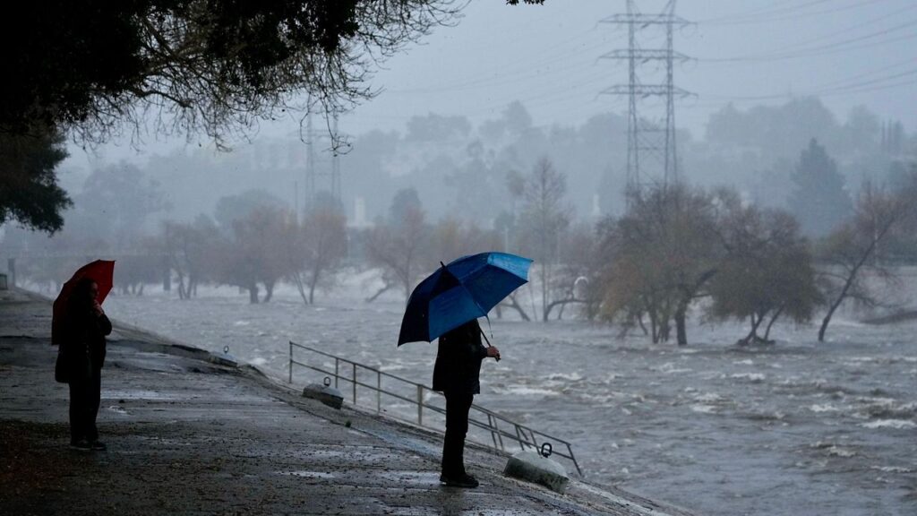
Los Angeles, California — Southern California is preparing for a midweek storm expected to bring measurable rainfall, possible thunderstorms and renewed coastal hazards as communities continue dealing with damage from weeks of powerful surf and unusually high tides.
The first non-tropical storm of the rainy season is developing over the Pacific and is forecast to bring rain to the region Wednesday and Thursday. Along the coast, officials are also watching for elevated surf, dangerous rip currents and additional beach erosion that could threaten already vulnerable areas.
The National Weather Service has warned that the storm could produce heavy downpours in some locations, increasing concerns about localized flooding and debris flows, particularly near areas affected by recent wildfires.
When Will the Storm Hit Southern California?
Rain chances are expected to increase throughout Wednesday before showers continue into Thursday. The National Weather Service said in its Tuesday morning forecast discussion that widespread activity was likely across the forecast area Wednesday night into Thursday morning.
Clouds and steady rain are expected to reach the Central Coast first, with showers potentially extending south toward Ventura County.
By Wednesday afternoon, Los Angeles County faces a 60% to 70% chance of rain, according to the forecast information provided.
Thursday could bring another round of showers, with conditions becoming particularly favorable for thunderstorms across Los Angeles and Ventura counties.
Meteorologists have also identified a 30% to 40% chance of cloud-to-ground lightning in the affected areas. Any thunderstorms that develop could produce brief periods of heavy rainfall and small hail.
The storm is expected to move east, with most rainfall activity leaving the region by Thursday evening. However, the timing and intensity of individual showers could vary across Southern California.
How Much Rain Could Fall?
The incoming system is expected to deliver a meaningful amount of rainfall to areas that have experienced a relatively dry period.
Coastal and valley locations could receive approximately 0.5 to 1.5 inches of rain, while south-facing mountains and foothills could see between 1.5 and 3 inches.
Thunderstorms could push rainfall totals even higher in isolated locations, making localized weather conditions especially important during the storm.
The National Weather Service has warned about the potential for minor flooding and debris flows. Areas near recent burn scars could be particularly vulnerable because wildfire damage can leave hillsides less able to absorb rainfall and more susceptible to runoff.
Residents in vulnerable areas should pay attention to weather alerts and avoid crossing flooded roads or moving water. Heavy downpours can create hazardous conditions even when rainfall is relatively short-lived.
Snow is not expected to be a significant concern with this system. The Weather Service said snow levels would remain above 8,000 feet, keeping the main precipitation impacts focused on rain and coastal conditions.
Beach Hazards Raise Concerns Along the Coast
The storm is also expected to affect Southern California’s beaches, where recent surf and high tides have already caused substantial erosion.
The National Weather Service has issued a beach hazards statement for coastal areas of Los Angeles, Ventura and Orange counties because of the potential for beach erosion and tidal overflows.
In Los Angeles and Ventura counties, the statement is expected to remain in effect through Thursday evening. Elevated surf and dangerous rip currents could create hazardous conditions for swimmers and other beachgoers.
Rip currents can pull people away from shore, while powerful waves can knock people off their feet or sweep them into deeper water. Even experienced swimmers may struggle in these conditions.
Beachgoers should follow posted warnings, stay away from hazardous surf and avoid entering the water when conditions are dangerous.
Long Beach Races to Protect an Eroding Peninsula
Long Beach is facing particular concerns as officials and crews work to protect a shoreline damaged by weeks of powerful surf and unusually high tides.
According to a report, city crews were working to pump hundreds of thousands of cubic yards of sand back onto the eroded beach in an effort to protect nearby homes.
The Long Beach Peninsula has taken a significant hit from three major storms over approximately six weeks. Waves have destroyed portions of the boardwalk and contributed to severe erosion near residential properties.
The damage has been serious enough that seven residential buildings have been red-tagged, meaning they have been designated unsafe to enter.
The latest storm could add pressure to an already difficult coastal situation. Officials are racing to restore sand and reduce the risk to homes as another round of unsettled weather approaches.
What Residents Should Watch For
The main concerns through Thursday are heavy downpours, isolated thunderstorms, localized flooding, debris flows and dangerous coastal conditions.
Residents near burn scar areas should monitor official warnings, while people living along vulnerable shorelines should remain alert to updates from local authorities.
Those planning beach visits should check current advisories before heading out and avoid dangerous surf and rip currents. Coastal conditions can change quickly, particularly when strong waves combine with high tides.
Although the storm is expected to move east by Thursday evening, its effects could extend beyond rainfall, especially along already eroded beaches.
Are you in Southern California? Have you noticed the recent beach erosion or changes in the weather near your area? Share your local conditions and storm preparations in the comments below.