
LOS ANGELES, Calif. — September is normally one of the driest times of year in Los Angeles, when Southern California is still firmly in its warm, dry transition from summer toward fall. But this year, the remnants of Hurricane Marie brought an unusual dose of tropical moisture to the region.
The active eastern Pacific hurricane season, fueled by a powerful Super El Niño, helped send the remnants of Marie inland, opening the door to showers and coastal impacts across Southern California.
The rainfall is particularly notable because September typically brings very little precipitation to Los Angeles.
According to the National Weather Service, Los Angeles normally receives only 0.21 inches of rain throughout the entire month of September.
This time, however, the remnants of Marie have already pushed rainfall totals well above what residents typically see during the month.
Los Angeles Airport Records Nearly Three Times Normal Rainfall
At Los Angeles International Airport, rainfall has already reached 0.60 inches this month.
That total is nearly three times Los Angeles’ typical September rainfall, highlighting just how unusual the weather pattern has been. For a city accustomed to long stretches of dry weather during September, even a relatively modest amount of rain can stand out.
The arrival of tropical moisture from Marie created a sharp departure from the usual late-summer pattern, bringing showers and clouds to parts of Southern California.
The unusual rainfall has also raised interest in how much more precipitation Los Angeles could receive before September comes to an end, with prediction markets forecasting potential outcomes for the city’s monthly rainfall total.
Hurricane Marie Also Brings Powerful Surf
The remnants of Marie have done more than simply bring rain.
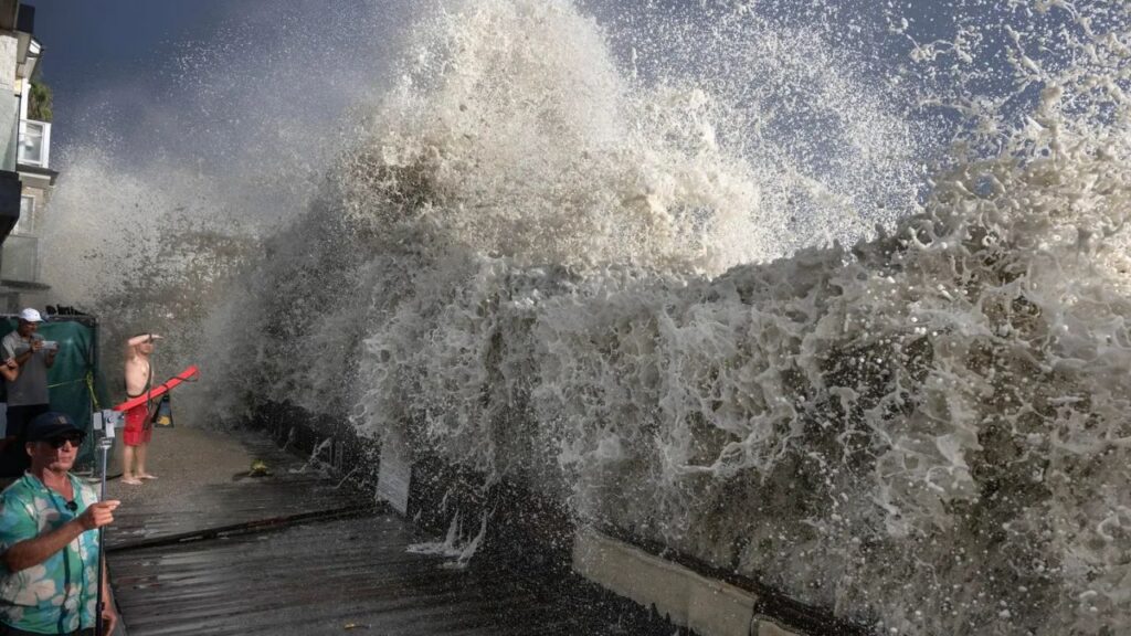
The storm system also generated powerful surf along some of California’s iconic beaches, adding another coastal impact to an already unusual weather event.
The increased wave energy has contributed to accelerated coastal erosion, creating additional concerns along exposed stretches of the Southern California coastline.
For residents and visitors near the coast, the combination of tropical moisture, elevated surf and erosion has made Marie’s remnants noticeable even though the system is no longer a full-fledged hurricane over the region.
The unusual weather serves as a reminder of how tropical systems can still influence areas far from the storm’s original path after weakening and moving inland.
Hot and Dry Weather Expected to Return
Despite the rare rainfall, Southern California’s wet spell is not expected to last.
According to the National Weather Service, a strengthening ridge of high pressure is expected to bring several days of hot and dry weather to the region after the remnants of Marie move away.
That shift will make additional widespread rainfall increasingly unlikely for Los Angeles and surrounding areas.
In other words, the tropical moisture may have made a brief appearance, but Southern California’s familiar September pattern is expected to return.
The contrast is striking: residents went from a normally dry September to an unusual burst of tropical rainfall, followed by a return to hot, dry conditions.
For now, Marie’s remnants have provided Los Angeles with a rare September weather event that stands out against the city’s typically dry climate.
As the system departs and high pressure takes control again, Southern California is expected to return to its regularly scheduled September programming — sunny, hot and mostly dry.
Did you experience the unusual September rain in Los Angeles or Southern California? Share what the weather was like where you live in the comments.






One thought on “Rare September Rain Hits Los Angeles After Hurricane Marie Remnants Sweep Into Southern California”