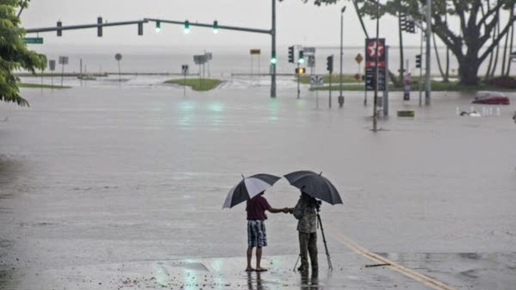
Honolulu, Hawaii — Hawaii is bracing for another round of heavy tropical rainfall as a deep plume of moisture moves across the island chain, raising concerns about flooding, hazardous travel conditions and possible mudslides in mountainous areas.
The developing weather pattern is expected to bring periods of persistent rain as tropical moisture interacts with Hawaii’s rugged terrain. More than 5 inches of rain had already been reported across the islands during the week, according to the supplied weather report.
With additional rainfall possible, a Flood Watch was reported in effect for the entire Hawaiian island chain through Thursday morning. The latest forecast and official alerts should be checked for any changes to the watch period.
Why Is Hawaii Facing Another Round of Heavy Rain?
The developing threat is linked to a broad area of tropical moisture moving north toward Hawaii. This moisture plume is part of an active tropical weather pattern carrying abundant water vapor toward the islands.
When this moisture reaches Hawaii, the islands’ mountainous landscape can help intensify rainfall. Moist air is forced upward along mountain slopes, where it cools and condenses, potentially producing prolonged periods of heavy precipitation.
This process can result in substantial differences in rainfall across relatively short distances. Some locations may experience persistent downpours while other areas receive considerably less rain.
The combination of a deep tropical moisture supply and Hawaii’s steep terrain is increasing concerns about additional rainfall over areas that have already received significant precipitation.
Another 5 Inches of Rain Possible Across the Islands
The forecast information indicates that an additional 5 inches of precipitation could fall in parts of Hawaii, including areas stretching from Maui to the Big Island.
If that rainfall develops, saturated ground and continued downpours could increase the risk of flooding in vulnerable locations.
Heavy rain over a short period can overwhelm drainage systems, send water across roads and cause streams to rise rapidly. Prolonged rainfall can also saturate hillsides, increasing the potential for slope failures and mudslides.
The amount of rain received will depend on where the heaviest moisture bands develop and how long they remain over individual islands.
Residents should avoid assuming that conditions will be the same across the entire state. Local rainfall totals and hazards can vary significantly depending on elevation, terrain and the movement of rain-producing clouds.
Flooding and Mudslides Remain Major Concerns
Flooding is one of the primary hazards associated with the developing weather system.
Areas that receive repeated downpours could experience water accumulation on streets, flooding near streams and difficult driving conditions. Low-lying locations and places with poor drainage may be particularly vulnerable.
Mudslides and other slope-related hazards are also possible in higher-elevation areas if heavy rain continues to saturate the ground.
Mountain roads and routes running along steep slopes may become dangerous during periods of intense rainfall. Even after the heaviest rain ends, runoff can continue moving into streams and lower-lying areas.
Residents should never attempt to drive or walk through floodwater. Water depth can be difficult to judge, and moving water can sweep away vehicles or people.
People living near streams, drainage channels or slopes prone to flooding should pay attention to official warnings and be prepared to move to safer locations if conditions deteriorate.
What Should Hawaii Residents Do Now?
With additional rain possible, residents should monitor local weather updates and alerts from the National Weather Service and local emergency management officials.
Shark Suspected of Damaging California Fisherman’s Kayak, Forcing Him Into a Long Swim
People can take several precautions before conditions worsen:
- Clear leaves and debris from drains where it is safe to do so.
- Secure outdoor items that could be displaced by strong winds or runoff.
- Avoid flooded roads, streams and areas where water is moving rapidly.
- Watch for signs of unstable slopes, including new ground cracks or sudden changes in water flow.
- Follow evacuation instructions and other guidance issued by local authorities.
Drivers should allow extra time for travel and be prepared for reduced visibility, standing water and sudden changes in road conditions.
How Long Will the Rain Continue?
The supplied forecast points to a period of heavy rainfall extending through the reported Flood Watch period, with the watch scheduled to last through Thursday morning.
However, the exact timing and location of the heaviest rain may change as the tropical moisture plume moves across the state. Residents should consult updated local forecasts rather than relying solely on earlier rainfall projections.
The potential for another 5 inches of precipitation makes continued monitoring especially important in areas that have already experienced substantial rainfall.
Hawaii’s mountainous terrain can concentrate runoff and contribute to localized flooding even when rainfall totals differ between nearby communities.
Are you experiencing heavy rain on your Hawaiian island? Share what conditions look like in your area and let others know about any flooding or travel problems in the comments below.