Hilo, Hawaii—Hawaii could face another round of dangerous weather this week as Tropical Rainstorm Norbert moves west toward the islands, potentially increasing the risk of flooding after an unusually active and deadly hurricane season.
As of early Tuesday morning, Hawaii time, Norbert was losing wind intensity about 780 miles east of Hilo. The system is expected to continue drifting west through the end of the week while producing a broadening area of showers and thunderstorms.
Hurricane Experts said Norbert’s moisture could eventually enhance rainfall across parts of Hawaii.
“Norbert will continue to drift west through the end of the week as a broadening area of showers and thunderstorms,” Hurricane Experts said. “Late this week, we expect Norbert to enhance trade wind showers over portions of the Hawaiian Islands, which could lead to localized flooding.”
The additional rainfall could create problems in areas where infrastructure has already been affected by previous storms.
Heavy rain could bring flooding and mudslides
Forecasters are watching Norbert’s moisture because even if the system does not directly strike the islands, it could still increase rainfall across Hawaii.
Heavy rainfall could trigger flash flooding, mudslides and additional washouts, particularly in locations where drainage systems remain damaged or clogged.
Thunderstorms could also produce locally strong wind gusts as the moisture moves across the islands. Exposed coastal areas could see rough surf, while some squalls may produce stronger bursts of wind.
“Some squally showers and thunderstorms could produce wind gusts of 20-30 mph,” experts said.
A few waterspouts could also develop, according to the forecast.
For communities still dealing with the effects of previous tropical systems, another period of heavy rain could create additional challenges.
Norbert would be the seventh tropical system near Hawaii
Norbert is expected to become the seventh tropical storm or hurricane this summer to pass within several hundred miles of the Hawaiian Islands or send moisture into the state.
That level of activity is unusual for Hawaii, where close approaches by tropical systems are relatively uncommon.
“Of the multiple tropical cyclones that have ventured into Hawaii’s neighborhood, two brought direct impacts to the islands,” they said.
Those storms were Lala and Lowell, both of which produced significant consequences for Hawaii.
Lala brought deadly flooding and major damage
Lala formed in the central Pacific and strengthened into a Category 1 hurricane as it passed near South Point on the Big Island.
After moving away from Hawaii, Lala strengthened further and eventually reached Category 4 strength, with maximum sustained winds of 130 mph.
The storm was blamed for two direct deaths and one indirect fatality. Torrential rainfall caused widespread flash flooding, while Laupāhoehoe on the Big Island recorded 43.42 inches of rain, according to the National Weather Service.
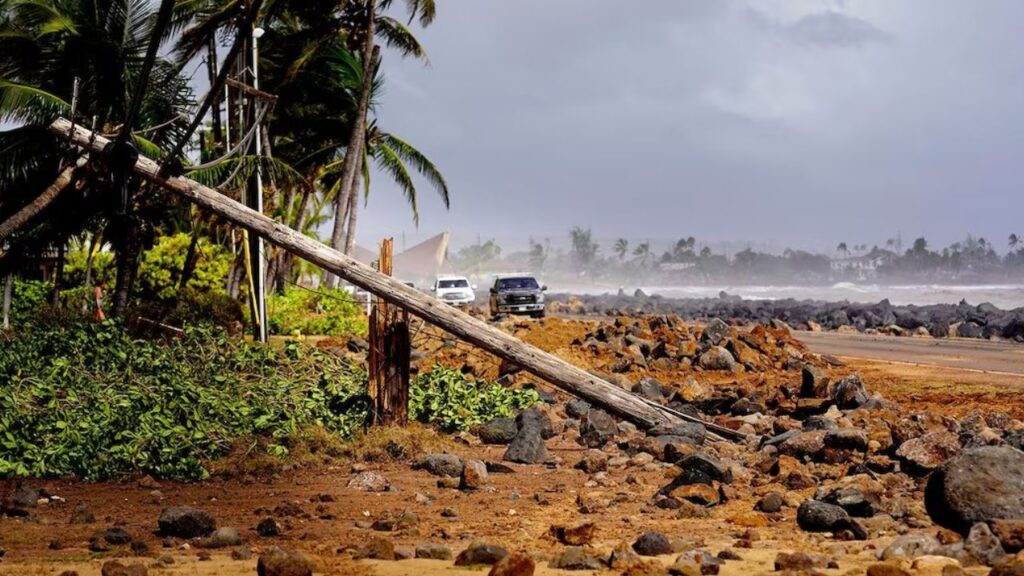
Floodwaters swept away homes and destroyed bridges and roads. Strong winds also knocked down trees and caused widespread power outages.
Lowell caused more deaths and destruction
Lowell later became the strongest hurricane of the 2026 eastern and central Pacific seasons to date, reaching maximum sustained winds of 160 mph on Sept. 2 while less than 450 miles south-southeast of Hilo.
The storm eventually passed about 40 miles west of Niʻihau on the night of Sept. 7, Hawaii time, after making a sharp northward turn.
Phoenix and Parts of the Southwest Face Days of Storms as Tropical Moisture Surges North
Lowell was blamed for two deaths, including one involving a falling tree on Oahu and another caused by coastal flooding on Kauai.
The hurricane also caused significant damage across western Hawaii, particularly on Kauai and Niʻihau, with destructive waves, coastal flooding, hurricane-force wind gusts and freshwater flooding.
Hawaii watches another round of severe weather
Tropical storms and hurricanes rarely pass close to Hawaii’s main islands after September. On average, fewer than one tropical system per year passes within 100 miles of the main islands, while many years see no such close approaches.
Only two hurricanes — Dot in 1959 and Iniki in 1992 — have made landfall in Hawaii in the modern historical record.
With Norbert now moving west and its moisture potentially reaching the islands later this week, residents will be watching rainfall forecasts closely as Hawaii faces another possible round of flooding, thunderstorms, strong wind gusts and rough surf.
How concerned are you about another tropical system bringing heavy rain to Hawaii? Share your thoughts in the comments.