
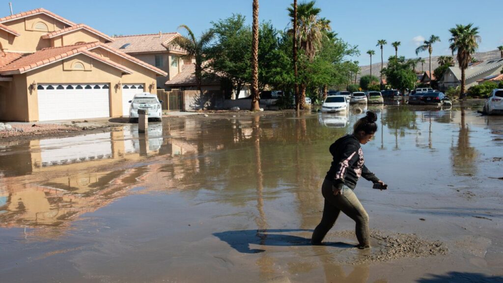
Phoenix, Arizona — Heavy rain and potentially dangerous flooding are expected to intensify across parts of the Southwest as a rare tropical disturbance in the Gulf of California adds even more moisture to an already active monsoon pattern.
The setup is being driven by a massive heat dome stretching across the Central and Eastern U.S. The heat dome will act like an atmospheric wall, helping trap monsoon conditions along its western edge.
That pattern is expected to send a surge of tropical moisture into Arizona and New Mexico, where widespread thunderstorms could produce repeated rounds of heavy rainfall through Friday.
The region faces a Level 2 out of 4 flash flood threat, with some areas potentially seeing several rounds of storms over the coming days.
Tropical moisture could increase storm coverage
The weather pattern is being strengthened by airflow around a high-pressure ridge to the east. That circulation is expected to continuously pull tropical moisture northward from the Pacific.
At the same time, upper-level energy moving around the western side of the heat dome will provide additional lift in the atmosphere.
The combination could create an environment where storms repeatedly develop during the afternoon and produce heavy rainfall over the same general areas.
With the moisture plume remaining in place, the concern is not simply one isolated storm. Repeated rainfall can quickly increase runoff and overwhelm already saturated ground, especially in areas with steep terrain or poor drainage.
Flood Watches stretch across Arizona and New Mexico
Flood Watches are in place for southern Arizona and western and southern New Mexico through Wednesday, according to the forecast information provided.
The threat also extends into Utah, including Zion National Park, where heavy rain can create dangerous conditions in canyons, washes and other vulnerable terrain.
Cities including Phoenix and Tucson, Arizona, along with Ruidoso, New Mexico, are among the communities expected to see persistent rainfall.
Rainfall totals of approximately 1 to 2 inches are expected in some areas, while higher elevations could receive 2 to 3 inches or more.
Even those amounts can create serious problems when rainfall arrives repeatedly over a short period.
Rare Gulf disturbance adds another concern
Adding to the situation is an area of disturbed weather currently located in the Gulf of California.
Tropical disturbances in the Gulf are relatively uncommon, and according to the National Hurricane Center, such systems generally have a low chance of developing into a named storm or tropical depression.
The bigger concern for the Southwest is the moisture associated with the disturbance.
As the system moves onshore into Mexico on Wednesday, its moisture could surge north toward the Four Corners region, potentially increasing the coverage and intensity of showers and thunderstorms across the Southwest.
Saturated ground could worsen flooding
Repeated storms are particularly concerning because the soil will have less capacity to absorb additional rainfall.
When heavy rain falls over areas that have already received substantial precipitation, water can rapidly flow into desert arroyos, low-lying areas and drainage channels.
Chicago Weather Alert: Storm Chances Surge Tonight as Severe Weather Threat Builds Tomorrow
Forecasters warned of the potential for severe flash flooding, rapid runoff, mudslides and dangerous debris flows, particularly in steep terrain and areas affected by recent wildfires.
Monsoon storms can also trigger mudslides, making conditions especially dangerous around mountains, burn scars and other vulnerable locations.
For residents and visitors across Arizona, New Mexico and nearby parts of the Southwest, conditions could change quickly through the week. Flash flooding can occur with little warning, even outside areas receiving the heaviest rainfall directly.
Anyone traveling through flood-prone areas should remain alert to changing weather conditions and local warnings as the monsoon pattern and tropical moisture continue to interact.
Are you expecting heavy rain or storms in your area this week? Share your weather experience and thoughts in the comments.






2 thoughts on “Phoenix and Parts of the Southwest Face Days of Storms as Tropical Moisture Surges North”